
| Area | Salmon River |
| Topic | Temperature: Temp Max SF Salmon Longitudinal 2002 |
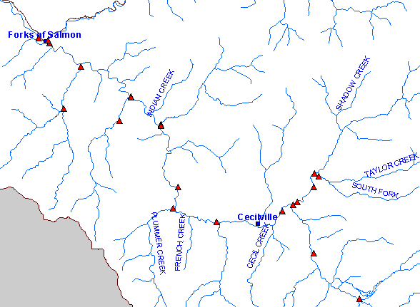
| South Fork Salmon Temperature Monitoring Sites 2002. Scale = 1:193,594 . | |||
 |
 |
||
To view metadata about a map layer, click on a link in the table below.
| Name of Layer in Map Legend | Metadata File Name |
|---|---|
| Temperature Monitoring Sites 2002 | hobo2002.shp.txt |
| Towns | towns.shp.txt |
| Streams (1:100k scale) | rivers.shp.txt |
| Salmon River Road | mainrds.shp.txt |
| Basin Buffer | buffer_basinboundary.shp.txt |
| Basin Boundary | basin_bnd_arc.shp.txt |
| www.krisweb.com |