|
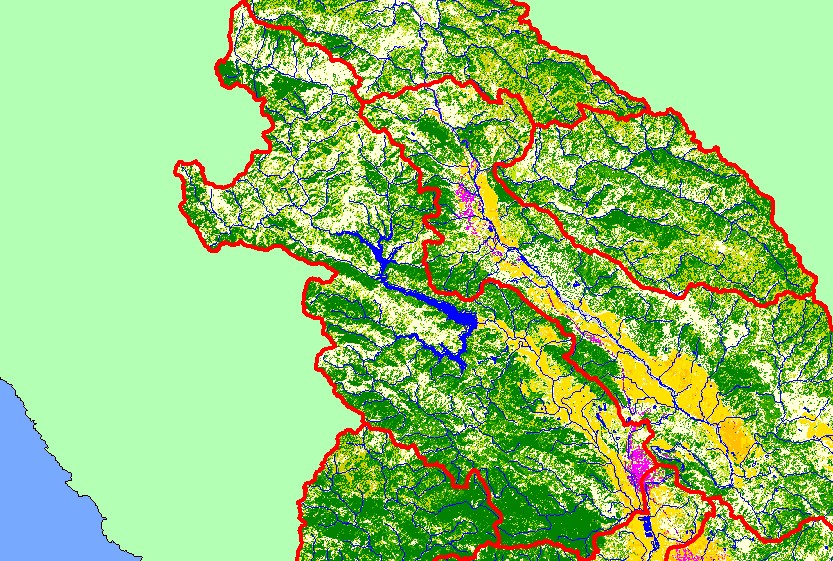
This is a map of EPA Landcover/Landuse in the Warm Springs sub-basin, based on a 1992 Landsat TM satellite image. The residential (pink) and industrial (purple) in
the southwestern portion of the sub-basin is Healdsburg. Most of the Dry Creek valley is covered in vineyards and orchards. The southwestern portion of the sub-basin
contains significant patches of conifers. The remainder of the sub-basin is a mix of conifers, hardwoods, grasslands, and herbaceous vegetation. Data were provided by
the U.S. Environmental Protection Agency.
|
|